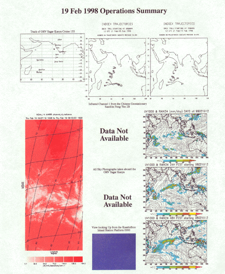
Feb. 19,1998 Day No. 50 Ship Location: 13o49'N, 71o34' E
Similar meteorological situation persists. The ITCZ cloudiness now extends to the southern tip of India as seen from NOAA-AVHRR cloud images. FY-2 images are not available. Cloud pictures taken at 0900 UTC at Kaashidhoo indicate clear sky conditions. The boundary layer flow near Kaashidhoo is northerly. The FSU model analyses indicate development of convective activity east and north of Madagaskar. No satellite coverage of the area is available to confirm this.