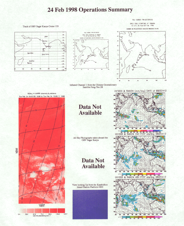
Feb. 24,1998 Day No. 55 Ship Location: 04o42'N, 73o45'E
Sagar Kanya has sails out of Indian EEZ towards Malť. NOAA-AVHRR cloud image shows that ITCZ activity is largely confined to south of Equator. A very E-W narrow band of low level cloudiness extends across the middle Arabian Sea. FY-2 data continue to be unavailable. At Kaashidhoo, the sky is clear and the boundary layer flow is indicated to be from the East. FSU model analyses indicate further deepening of the convective system off Madagaskar.