|
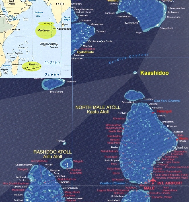
Male, the capital of the Maldives is 1.7 x 1.1 km large and located at the south end of Kaafu Atoll (Figure 3). It hosts about 60 000 of the 230 000 Maldivian inhabitants and is very close to Hulule, the airport island (Figure 7). Most of the hotels on Male are located on the NE corner with direct boat shuttle to the airport (usually $1 to $5 per person, but can amount to more than $50 in very rough weather). Mechanical workshops for wood and metal, hardware and electrical shops can be found everywhere on the island and the center road (Majeedhee Magu) is the main shopping area. The harbor for large ships is at the north end (see jetty) and can accommodate container ships. From there, transport of heavy equipment can be organized to Hulule. 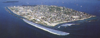 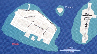
Hulule is the first point of contact for every visitor coming in from overseas (Figure 8). The airport terminal is in the center of the island (to the left of the large, concrete tarmac). The meteorological office is just north of that and the harbor can be seen on the left, surrounded by several jetties. Field operation offices could be set up somewhere in the center part, close to the Met office, which can also provide some space for scientific operation (LIDARs, balloons etc.). According to the airport manager, Mr. Mohamed Ibrahim, there is no space on the airport to accommodate the field office. However, we have seen several container offices, which are probably a practical solution for INDOEX needs. Flight operations and the field project office will be coordinated by the UCAR Joint Office of Science Support (JOSS) for the 1999 Intensive Field Phase. 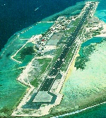
Airport access other than departure or passenger pick-up costs Rf 2.- entrance fee. Permanent photo-ID permits will be arranged on site for INDOEX intensive field phases. Space for LIDARs, ISS, SABL is available on the island. However, instrumentation must be flown in or shipped in from the Male harbor via boat, because the Hulule harbor is only 15 ft deep. According to an Air Taxi manager, there is one point outside the harbor, where larger ships could dock if necessary, but this would likely require special permission and careful planning. Smaller boats can land at the pumping station for fuel, which is around the same area (CIMEL jetty). Either way, the load is limited in weight to 6.5 tons per piece, as this is the limit of the available crane of Maldivian Air Taxi (PTE.) Ltd. (Mr. Jesper Hougaard, general manager). This crane is usually used for aircraft loading and unloading but would be available upon request for a fee of Rf 1000 per hour. Any heavier equipment will need a special request for a larger crane to be transported in from the harbor. The Met office (Mr. Abdul Muhusin, chief forecaster, Mr. Abdulla Algeen, 2nd forecaster; The deputy minister of MPHRE, Dr. Abdullahi Majeed, is also the Executive Director of the Met office) has five stations in the Maldives, three of which are daytime only operations (Khadudhor, 1.88°N, 73.5°E; Kaadedhohoo, about 1°N, 73.5°E; Gan, 0.68°N, 73.53°E, 5-17 local = 0-12 UT), two are 24-hour operations (Hulule, 4.19°N, 73.53°E, and Hanimaadhor, 6.71°N, 73.15°E). From these stations, the office can provide the following data:
Tidbits:
|